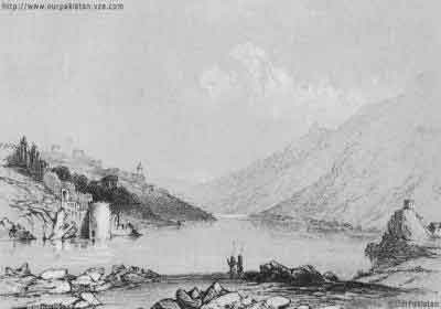
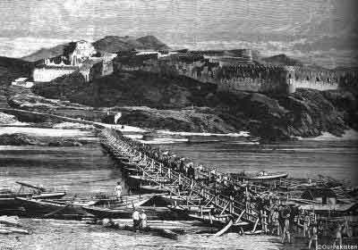
Engraving published in The Illustrated London News,
10 March 1849.
In this sketch provided to The Illustrated London News by an 'obliging
correspondent', the inherent dramatic location of the Attock fort, poised
on the banks of the river Indus south of the point where it receives the
river Kabul, has been further accentuated.
Ranjit Singh took the fort in 1812-13 by stratagem from the Wazir of Kabul
and from then onwards until 1849, when the Sikhs themselves were defeated,
the fort remained under their control.
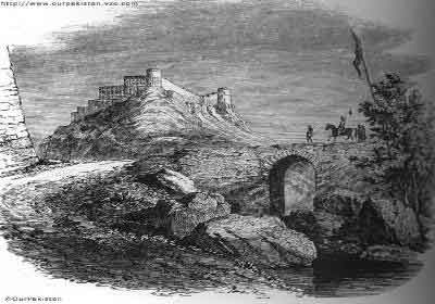
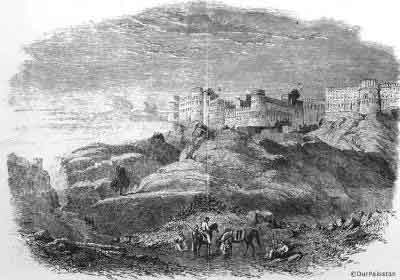
Engraving published in The Illustrated London News,
10 March 1849.
In 1831, William Moorcroft was given express permission by Ranjit Singh
to tour the fort and noted this informative description of its interior:
'Proceeding from the serai to the gateway on the north, along aperfectly
good road, unprovided with any defences, we entered into a small projecting
court, about twenty yards long, in which Shuja-al-mulk was confined by
Jehandad Khan, after he was driven from Afghanistan. From hence we passed
through another gate into the bazar, a narrow lane of shops, chiefly for
the sale of provisions, and along this we conducted to the opposite or
southern gateway, which opened upon the side of the hill immediately above
the ferry over the Indus. The gates of the fort are lofty and
large, and the walls are of the same description as those of Rotas, thick,
crenated, and pierced with loopholes: the direction of the bazar is parallel
with the river, and the bazar is four hundred paces long:
between it and the river front are houses, and at the south-west angle
a bastion projects into the stream:
on the side of the bazar, farthest from the river, the fort contracts
and extends in the form of an irregular parallelogram, about five hundred
yards to the east. The interior is discernible from the right bank of
the river, and the eastern end is commanded by hills of greater elevation
than that on which it stands. Opposite to its southern face, and divided
from it by a ravine which descends to the bank of the river, stands a
petty village, on a level with the gateway. On the right bank of the river,
and within musketshot of the southern postern of the fort is the village
of Khairabad, defended on the west by a mud re doubt, and by several small
stone buildings, intended as stations for infantry, erected on different
points of a ridge of row hills, about a hundred yards to the westward;
the most remote is within range of artillery from the fort, and perfectly
commands the latter. This is the case, however, with even the road to
Peshawar, on the Khairabad side, and it would not be necessary to erect
batteries on the hills. The fort of Attok, however impregnable it may
be to Sikhs or Afghans, could oppose no resistance whatever to European
engineers.' (Moorcroft (1841; 1979 edition), II, 323-5.)
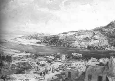
In the event, on the very day after this particular illustration was published
in London, over 6000 miles away at a spot near Rawalpindi, the Sikhs formally
surrendered their weapons to Major-General Gilbert on 11 March 1849, and
the fort was yielded without a skirmish to the British.